
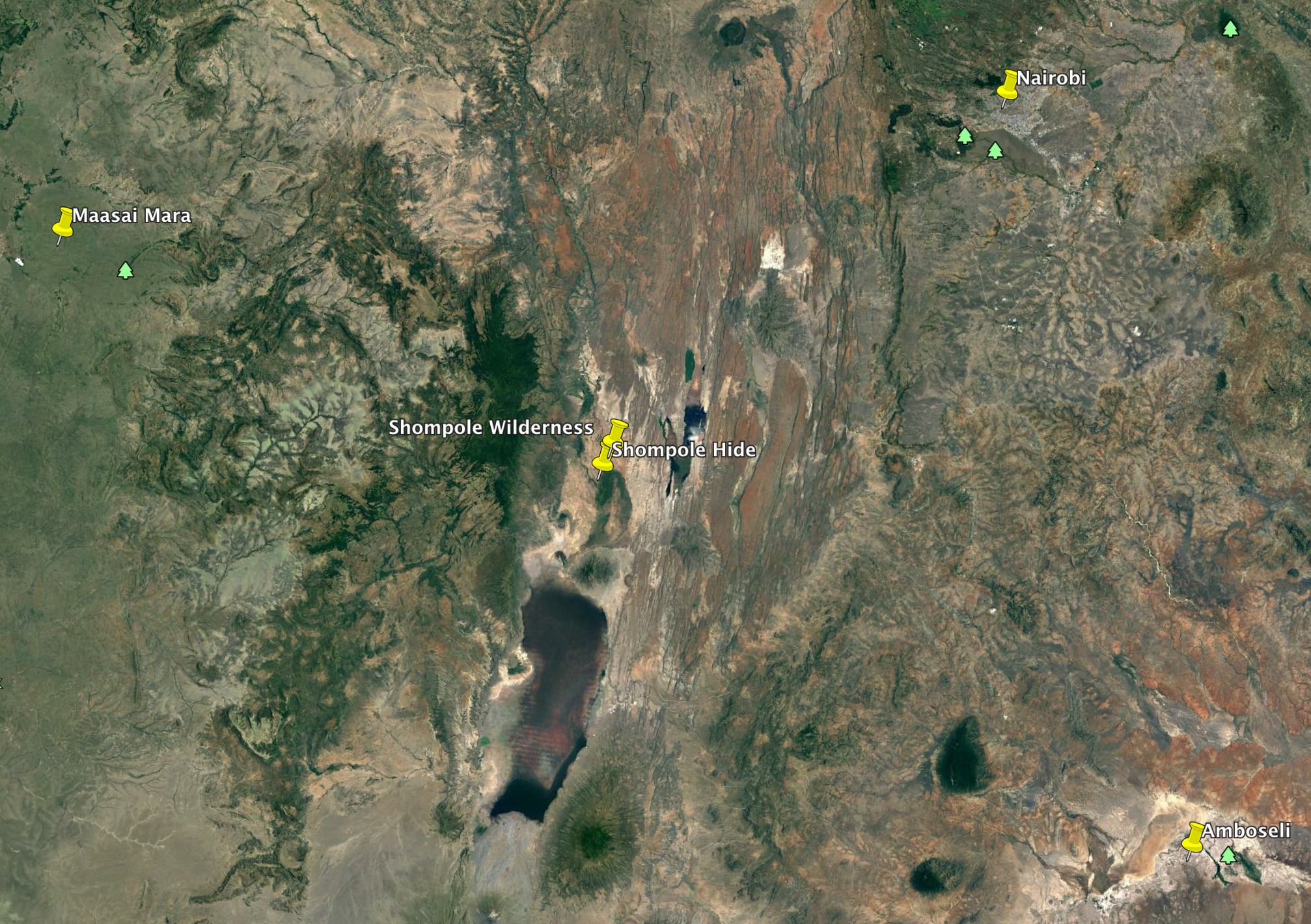
Where is Shompole Wilderness?
Shompole Wilderness is at the bottom of the Great Rift Valley at about 2,000 ft above sea level.
To the west we have the edge of the rift valley wall that towers 5,000 ft above us, and passed that you get to the famous Maasai Mara.
To the east we have Lake Magadi well known for its soda ash and flamingoes.
To the north we can follow the Great Rift Valley for thousands of kilometres right up to the Red Sea.
To the south we have Tanzania and the pink Lake Natron also well known for its flamingoes, and passed that the famous Ngorongoro Crater.
We are perfectly located in the way that we are only: 145km from Amboseli, 125km from the middle of the Maasai Mara (Olkiombo Airstrip), 100km from Nairobi, 23 km from Lake Natron and 22km to Flamingoes.
Directions.
FLY
This is by far the best way to get to us.
There is an airstrip 10 kilometres to the north of us near the research centre called RANGERS AIRSTRIP (Lat -1844083 Lon – 36.105917 (2,218ft)) near the Olkiramatian – Ngurumani bridge. It is 1,300 meters long, dirt and pretty much an all weather strip.
Several charter companies use the strip. Some of them are Scenic Air Safaris, Boskies and Yellow Wings.
ROAD
Nairobi to Magadi. Travel time about 2 – 2.5 hours, distance 100 kms +/- from Galleria shopping centre. Head towards the left of the Ngong Hills (I had a farm in Africa at the foot of the Ngong Hills – Karen Blixen). Depending on which road you take either go past Galleria shopping centre and towards Rongai and Kiserian OR go through Karen shopping centre and head towards Ngong Town. Then head towards the left of the Ngong Hills to Corner Baridi.
There after just follow your nose and stay on the tarmac (bad road) until you get to Magadi Town. You would have past through Ol Tepesi, and Olgorlgasile a pre historic site.
Magadi to Shompole Wilderness. Travel time about 1 hour, distance 30 kms +/-NOTE, if you ask for directions by locals, make sure you ask for the way to NGURUMAN and not SHOMPOLE as there is a town called Shompole and you will go 2 hrs the wrong way!
Once you get close to Magadi you see the Lake to your left. There is a barrier you will go through, once through follow the road up the hill (with the salt pans on your right and behind you). The road forks, go right and past the soda factory on your left. Over the railway tracks and towards the structure that looks like it has two arms sticking out, make sure you are to the left of it. As you approach there is a pump house on your left, go passed that and across the causeway. From here, again just follow the most used road, you will head north and then south and then west towards the Rift Valley wall. Just keep going. You will get to a small village called Olkiramatian Town. Here, we will have someone waiting for you and show you the way to camp. If you get to a metal bridge you have gone too far.
Shompole Wilderness ( Lat -1.926942 Lon – 36.127576 (2,109ft)).


